Location
Being located about 8 miles North of Mount Pleasant’s Town Center and 16 miles from downtown Charleston, all modern-day conveniences are readily accessible with the privacy and seclusion of a gated neighborhood.
Schools close to the neighborhood include Carolina Park Elementary School, Thomas C. Cario Middle School, and Wando High School. Roper St. Francis Mount Pleasant Hospital is less than five minutes away.
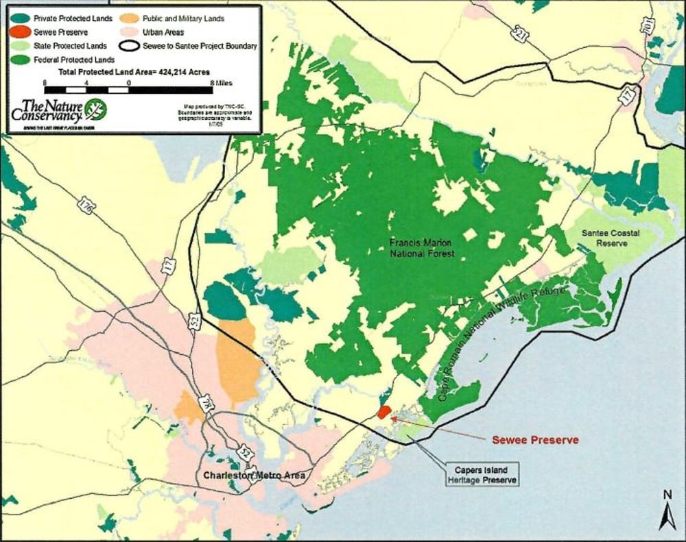
Sewee to Santee Corridor
The Sewee to Santee Corridor, shown on the map to the right, stretches along nearly 40 miles of South Carolina's undeveloped coastline beginning just North of Mount Pleasant and running to the Santee River Delta. Comprised of 73,000 acres of salt marsh and mud flats, the coastline is protected by six barrier islands. The Sewee to Santee Corridor encompasses the Francis Marion National Forest and Cape Romain National Wildlife Refuge, providing habitat for a multitude of animal and plant species, including the endangered wood stork and the Southern bald eagle.